
TL;DR

Prime made for students and young adults
- Fast, free delivery for dorm and study essentials
- Prime Video and Amazon Music included
- Member-only deals
NASA Earth Observatory published Landsat images showing the Carrot River Valley’s fields on July 2 and September 21, 2026. The area is Manitoba’s northernmost agricultural region, with more than 40,000 hectares of actively farmed land surrounded by wetlands; its 2026 crop inventory had not yet been released as of late September.
NASA Earth Observatory has published Landsat satellite images showing how fields in the Carrot River Valley, Manitoba’s northernmost agricultural area, changed from green in July to mostly brown by September 2026. The farmland sits amid the wetlands of the Saskatchewan River Delta, where farming on more than 40,000 hectares depends on dikes and pumping to reduce flood risk.
The images were acquired by the Operational Land Imager instruments aboard Landsat 9 on July 2 and Landsat 8 on September 21. NASA’s account says the July image shows green crops across many fields; by the later image, the valley’s colors had shifted as the growing and harvest seasons advanced. The report does not identify the crop in each field in the 2026 images.
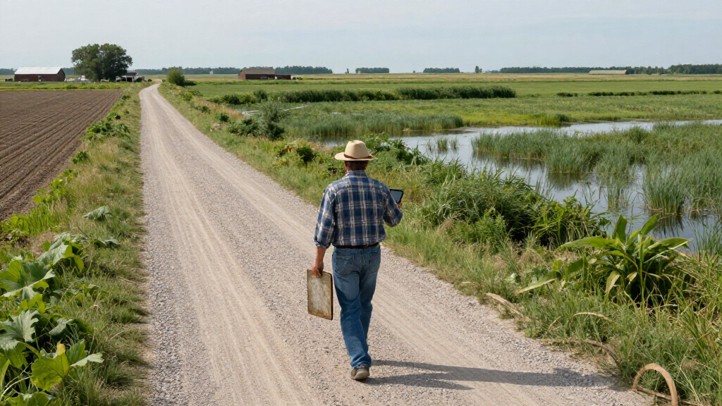
The valley lies west of The Pas, between the Carrot and Pasquia rivers, which flow into the Saskatchewan River. Its straight-edged fields stand out against the delta’s channels, lakes and marshes. The farmland is surrounded by wetlands, including the Saskeram Wildlife Management Area to the north.
The 2026 annual crop inventory from Agriculture and Agri-Food Canada had not been released by late September, according to NASA. The latest inventory cited in the report, for 2025, showed that farmers in the valley grew mostly canola and spring wheat, with smaller areas of Canary seed. Those figures describe the previous year and should not be read as a confirmed account of the 2026 crop mix.
Farming Between Rivers and Wetlands
The images show a farming area shaped by its location in a large, wet inland delta. The valley’s fields are not simply surrounded by wetlands; according to NASA, agricultural flood protection still relies on diking and pumping. That makes water management a continuing condition of farming there, rather than a background detail.
The timing of fieldwork and harvest also varies with local weather. NASA reported that wet conditions delayed planting in the valley compared with parts of Manitoba Agriculture’s Northwest crop reporting region farther south. Yet the area’s fertile soils and long northern summer days can support rapid crop growth. In September, the contrast between rainfall in The Pas and wetter parts of the wider region coincided with different harvest progress, illustrating how conditions can vary even within one reporting region.
For readers, the satellite views offer a dated record of seasonal change in a remote agricultural landscape. They do not, by themselves, establish crop yields, the extent of flood damage, or the overall success of the 2026 harvest. Those questions require information beyond the images.
flood protection dikes for farmland
As an affiliate, we earn on qualifying purchases.
As an affiliate, we earn on qualifying purchases.
A Delta Changed for Agriculture
The Saskatchewan River Delta straddles Saskatchewan and Manitoba. Much of it is too wet for extensive farming, while the Carrot River Valley forms a distinct agricultural area within the surrounding network of waterways and marshes. The valley is also known as the Pasquia Area Settlement and lies within the Rural Municipality of Kelsey.
NASA’s report says a major flood-control and drainage project began in the 1950s. Farming today continues to depend on dikes and pumps for agricultural flood protection. This history helps explain why a patchwork of regular fields appears as an agricultural “island” in satellite images of a predominantly wetland landscape.
The imagery comes from the Landsat program, whose data also feed into Agriculture and Agri-Food Canada’s annual crop inventory. NASA’s account was written by Kathryn Hansen, with images by Michala Garrison using data from the U.S. Geological Survey. The images document conditions on two specific dates, not continuous changes across the whole season.
crop irrigation pumps for wetlands
As an affiliate, we earn on qualifying purchases.
As an affiliate, we earn on qualifying purchases.
The 2026 Crop Picture Is Pending
The 2026 annual crop inventory had not been released as of late September, so the crop types and acreages shown in the 2025 inventory cannot confirm what was planted in the valley this year. NASA’s description of green and brown fields also does not provide field-by-field crop identification or yield estimates.
The report gives rainfall readings for The Pas and for wetter parts of the Northwest crop reporting region in the week before the September image, but it does not quantify the valley’s total rainfall over the season or report specific flood impacts. It also does not say how much of the valley’s harvest was complete. Regional harvest figures cited by NASA are not a valley-specific tally.
satellite imagery farm monitoring tools
As an affiliate, we earn on qualifying purchases.
As an affiliate, we earn on qualifying purchases.
Crop Inventory and Harvest Updates
The next detailed public account of crop distribution would be the release of Agriculture and Agri-Food Canada’s 2026 annual crop inventory, which NASA said was still pending in late September. That inventory can provide crop mapping beyond what is established by the two images, though the report does not give a release date.
Harvest progress may also become clearer through subsequent Manitoba Agriculture crop reports. NASA’s published comparison records the landscape on July 2 and September 21; further reporting would be needed to establish final harvest outcomes, crop yields, or any effects from flooding and wet conditions.
farming equipment for flood-prone areas
As an affiliate, we earn on qualifying purchases.
As an affiliate, we earn on qualifying purchases.
Key Questions
Where is the Carrot River Valley?
It is west of The Pas in Manitoba, between the Carrot and Pasquia rivers, within the Saskatchewan River Delta.
What do the 2026 satellite images show?
Landsat images from July 2 and September 21 show many fields appearing green in July and a shift toward brown by September. They are snapshots of two dates, not a field-by-field crop or yield assessment.
Which crops were grown in the valley?
The 2025 crop inventory cited by NASA shows mostly canola and spring wheat, with small areas of Canary seed. The 2026 inventory was not available as of late September, so the 2025 crop mix does not confirm this year’s plantings.
Why does farming there depend on water management?
The fields sit in a wet delta surrounded by rivers and marshes. NASA says farming continues to depend on dikes and pumping for agricultural flood protection.
Source: primary
Halloween Picks
halloween
As an affiliate, we earn on qualifying purchases.