
TL;DR

Prime made for students and young adults
- Fast, free delivery for dorm and study essentials
- Prime Video and Amazon Music included
- Member-only deals
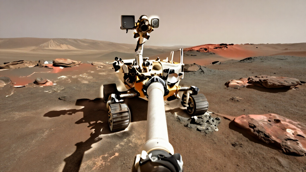
NASA’s Astronomy Picture of the Day for Oct. 3, 2026, features a Curiosity rover panorama made at Vera Rubin Ridge on Mars in January 2018. The accompanying caption notes that Curiosity reached a total elevation gain of 1 kilometer from Gale Crater’s floor on Aug. 26, 2026.
NASA’s Astronomy Picture of the Day for Oct. 3, 2026, features a Curiosity rover selfie taken at Vera Rubin Ridge on Mars on Jan. 23, 2018. The image’s caption also reports that Curiosity reached a total elevation gain of 1 kilometer on Aug. 26, 2026, during its climb from the floor of Gale Crater up Mount Sharp.
The panorama combines 61 exposures made with Curiosity’s Mars Hand Lens Imager, or MAHLI, according to the NASA APOD caption. The rover took the images on sol 1943 of its mission at the south rim of Vera Rubin Ridge. A sol is a Martian solar day, roughly 40 minutes longer than an Earth day; the caption identifies that sol as Jan. 23, 2018, on Earth.
The finished selfie is a mosaicked panorama, also composed as an interactive 360-degree virtual-reality view. Frames showing MAHLI’s mechanical arm were edited out. For the extended background, the image uses a separate view recorded by Curiosity’s Mastcam on sol 1903, earlier in the rover’s traverse.
NASA credits the image to NASA, JPL-Caltech and MSSS, with the panorama credited to Andrew Bodrov. The caption says the ChemCam housing atop the rover’s mast blocks the distant peak of Mount Sharp, which it describes as 5 kilometers high. It does not provide a new mission announcement or claim that the 2018 photograph was taken in 2026.
A Long Climb Through Gale Crater
The APOD item links a fixed moment in Curiosity’s exploration with a later measure of the rover’s progress. The selfie records the rover at Vera Rubin Ridge in 2018; the caption’s Aug. 26, 2026 milestone describes its accumulated elevation gain since leaving Gale Crater’s floor. Together, those details help readers place the photograph within a journey that continued for years after the image was captured.
The elevation figure is a measure of vertical gain, not the length of the route traveled or the rover’s distance from its landing site. The APOD caption gives no additional measurements or explanation of how the figure was calculated. Its importance here is as a concise marker of Curiosity’s ascent on the lower slopes of Mount Sharp, the central mountain in Gale Crater.
The panorama also shows how images used to present a rover can be assembled from multiple exposures. Removing the camera arm from selected frames and adding a Mastcam background makes a broad scene, but the caption discloses those steps. That distinction matters: the result is a constructed panorama based on rover images, rather than one single exposure.
As an affiliate, we earn on qualifying purchases.
From Sol 1943 to 2026
Curiosity’s selfie belongs to a much earlier point in the rover’s Mars work than the APOD publication date might suggest. NASA’s caption dates the MAHLI exposures to sol 1943, corresponding to Jan. 23, 2018, on Earth. The distant background comes from Mastcam observations made on sol 1903, so the panorama combines material gathered on two different mission days.
Vera Rubin Ridge is the location identified for the selfie: the south rim of the ridge. Mount Sharp rises within Gale Crater, and the caption describes the rover’s larger route as a climb from the crater floor up the mountain’s slope. The 1-kilometer elevation-gain statement refers to that route as of Aug. 26, 2026; it is not a measurement made when the selfie was taken.
NASA’s Astronomy Picture of the Day presents a selected image with an explanatory caption. For this entry, the credited authors and editors are Jerry Bonnell, Cecilia Chirenti, Robert Nemiroff and Keighley Rockcliffe. The image credit lists NASA, JPL-Caltech and MSSS, while the panorama credit names Bodrov.
As an affiliate, we earn on qualifying purchases.
Limits of the Caption’s Details
The source material does not give the rover’s exact position when it reached the 1-kilometer elevation gain, the method used to calculate that total, or the route distance associated with it. It also does not offer an updated status of Curiosity’s operations beyond the milestone date. Those details should not be inferred from the selfie or the brief APOD caption.
The panorama is explicitly a composite: its foreground images were taken on sol 1943, while its extended background came from sol 1903, and frames containing the camera arm were edited out. The caption does not specify the full processing workflow or how the interactive VR version presents the stitched scene. The image should be understood as a processed panorama from rover imagery, not a single unaltered camera frame.
Mars exploration virtual reality headset
As an affiliate, we earn on qualifying purchases.
As an affiliate, we earn on qualifying purchases.
The Next APOD and Mission Updates
NASA’s APOD page lists “Sunday’s Childe” as the picture scheduled for the following day. That is the next item in the daily image series, not a forecast of a Curiosity mission event. The source material does not announce a new rover milestone or provide a schedule for future operations.
For further mission developments, readers will need later updates from NASA or the rover team. Any new route, elevation, or operational information should be treated as a separate report from this retrospective image feature. The Oct. 3 entry itself documents the 2018 selfie and reports the 2026 elevation milestone.
As an affiliate, we earn on qualifying purchases.
Key Questions
When did Curiosity take the selfie?
The rover recorded it on sol 1943, which NASA’s caption maps to Jan. 23, 2018, on Earth.
How was the panorama made?
It combines 61 MAHLI exposures. Frames showing the imager’s arm were edited out, and the extended background came from Mastcam images taken on sol 1903.
What does Curiosity’s 1-kilometer elevation gain mean?
NASA says the rover reached a total elevation gain of 1 kilometer from Gale Crater’s floor on Aug. 26, 2026, while climbing Mount Sharp. The caption does not state the route distance or calculation method.
Was the selfie taken in 2026?
No. The photograph dates to January 2018. NASA published it as the Astronomy Picture of the Day on Oct. 3, 2026, alongside the later elevation milestone.
Source: primary
Halloween Picks
halloween
As an affiliate, we earn on qualifying purchases.